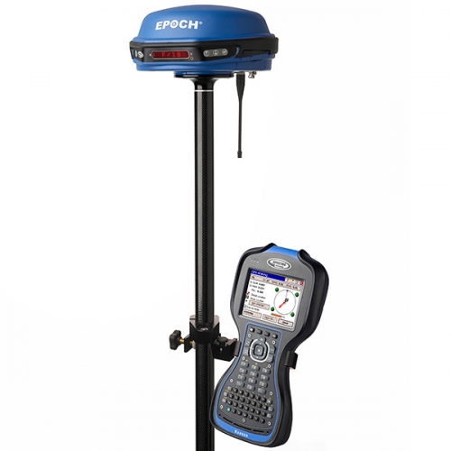
GPS Geodetik Spectra Epoch 50 RTK
Availability: In Stock
GPS Geodetik EPOCH EPOCH 50
- 220 Channels for Multi- Constellation GNSS support
- Integrated Transmit and Receive data link
- RTK, Static, and PPK
- Network RTK positioning
- Spectra Precision Survey Pro field software
- Support for all GNSS data with
- Spectra Precision Survey Office software
GPS Geodetik Spectra Precision EPOCH 50 GNSS system, with its 220 channels, makes effective use of the GPS L1/L2/L2C/L5 and GLONASS L1/L2 signals for outstanding satellite coverage and precise positioning. The EPOCH 50 uses proven technologies to provide both an extremely stable phase center and tracking of the new stronger L2C and L5 signals.
GPS Geodetik EPOCH 50 GNSS with Survey Pro provides field crews with the tools and capabilities to get the job done. With maximum stability, precision, quality, and easy to use work flows, the EPOCH 50 GNSS is packed full of proven technologies that you can rely on day-to-day.
GPS Geodetik EPOCH 50 GNSS receiver has an internal transmit and receive radio modem so that either receiver may be used as a base or rover. Use the internal radio on a construction site for a quick and easy setup. The EPOCH 50 GNSS also supports external radio and cellular modems for added flexibility and range. In addition communicate cable free with Bluetooth® to your choice of world-class Spectra Precision data collectors.
GPS Geodetic EPOCH 50 provides added productivity and cost savings with support of RTK Network technology for single base and NTRIP operations. Connect to networks with Spectra Precision WWAN enabled data collectors for added flexibility.
Designed with greater than 99.9% reliability initializations, GPS Geodetik EPOCH 50 GNSS provides fast, high quality results in all supported survey modes. Consistent accurate results, quality construction, and affordable pricing make the EPOCH 50 GNSS the ideal choice for a productive business
Spectra Precision Survey Office software provides a complete office solution for post-processing GNSS data and adjusting terrestrial survey data. Export your processed and completed results directly back to the field or design software packages using a variety of file formats.
Write a review
Your Name:Your Review: Note: HTML is not translated!
Rating: Bad Good
Enter the code in the box below:


