Your shopping cart is empty!
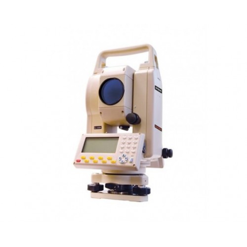
David White DTS05 Total Station
Product Code: David White DTS05 Total Station
Availability: In Stock
Availability: In Stock
David White DTS05 Total Station
- 5-Second angular accuracy
- 30X magnification
- 1º 30' field of view
- Up to 8,202-ft.(2,500m) range with 3 prisms, up to 5,249-ft.(1,600m) with 1 prism
- ±(2+2ppm x D)mm EDM accuracy
- Single axis tilt sensor
- Dual-sided graphic display and alphanumeric keyboard
- Ideal for surveying and construction, mapping and GIS, utilities, environmental studies, geomarking
Spesifikasi - David White DTS05 Total Station
- General: Weight: 12 lbs (4.8 kg); Dimensions: 21 in. x 17 in. x 14 in.; Warranty: 2-year manufacturer's warranty
- Angle Measurement: Measuring Method/Reading System: Raster Incremental; Detection Method: horizontal : double; vertical :single; Minimum Reading: 5-second; Accuracy: 5-second
- Tilt Sensor/Compensator: Range ±3 minutes
- Battery/Power: Power Source Ni-H charge battery; Battery Life: about 7 hours; Battery Life Alert: yes; Voltage: 7.2V
- Optical Plummet: Image: erect; Magnification: 4X; Field of View: 5 degrees; Focus Range: 0.5~8
- Level: Plate/Tubular Bubble Vial: 30 sec. per division/(2mm); Circular Bubble Vial: 8 min. per division/2mm
- Telescope: Length of Tube: 5.91 in.(150 mm); Image: erect ; Diameter of Objective Lens (Aperture): 1.77 in.(45 mm); Magnification: 30X; Field of View: 1 degree 30 arcmin; Resolving Power: 4.0 arcsec; Minimum Focus Distance: 4.92 ft; Ratio of Stadia Lines: 1:100
- Display and Keypad: Type: graphic LCD
- Temperature: Operating: -4Fº~122ºF (-20ºC~50ºC); Storage: -4Fº~122ºF (-20ºC~50ºC)
- Applications: Surveying and Construction: yes; Mapping and GIS (geographic information systems): yes; Utilities: yes; Environment Studies: yes; Geomarking: yes; Archaeology: yes; Accident Reconstruction: yes
- Measurement Range (under fair weather conditions): Single Prism: 5,249 ft (1.6 km); Triple Prism: 8202 ft (2.5Km)
- Functions: Coordinate Measurement Point: yes; Angle and Distance Stake Out: yes; Stake Out Line: yes; Offsets: yes; Missing Line: yes; Remote Elevation: yes; Resection: yes; Area Calculation: yes
Write a review
Your Name:Your Review: Note: HTML is not translated!
Rating: Bad Good
Enter the code in the box below:


