Your shopping cart is empty!
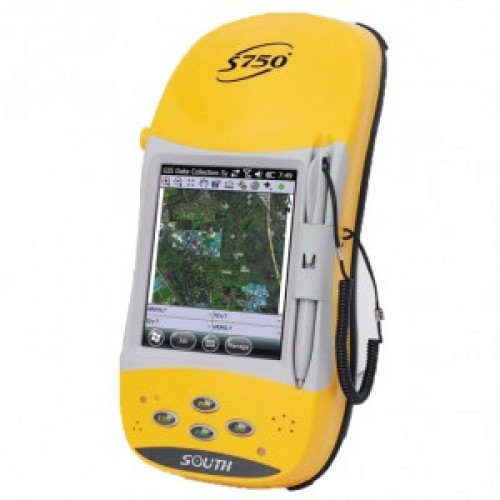
GPS Mapping South S750
Outstanding EVEREST Multipath Technology
The applied EVEREST multipath rejection technology provides a high accuracy solution for the code based mapping. The random errors in GPS measurements caused by multipath effect would be rejected for better quality data.
Professional GPS Module
High quality surveying-typed GPS antenna and mainboard, plus the lately adopted ASIC chip and patented algorithm COAST, ensure faster satellites tracking and more reliable positioning result, which portable navigation handheld GPS could be never compared with. Excellent performance is guaranteed even in bad conditions like under the tree, in the building corner, etc. due to multipath restrain effect and fast phase smoothing technology.
Post-Processed Kinematic
In PPK mode, the device can provide measurement result ranged from cm level to submeter level according to different conditions.
Easy Access to CORS
The inbuilt GPRS module helps the unit to access the CORS network seamlessly for RTD (Real Time Differential) corrections.
Static survey with high accuracy
Equipeped with external antenna, it can work with other GPS receivers to achieve mm level accuracy in static control survey mode.
Powerful Fieldwork Software
Completely new professional and user-friendly onboard software, GIStar, is an ideal solution for GIS data collection, yet very easy to use and convenient for data communication.
High Configuration Plus Mobile Phone Facility
More than a rugged handheld with highly configured controller components to deliver operational excellence for graphics processing and easy reading even in the strong sunlight, yet S750 can serve as a mobile phone to do calls, SMS/MMS messages and emails.
Flexible Bluetooth Applications
Bluetooth-enabled devices such as laser ranger finder, underground pipe locator, echo sounder could be wirelessly connected to S750 for data transfer. Even it may serve as a fieldwork controller for RTK survey.
Rugged Fieldwork Package
The integrated package consisting of GPS antenna, processing mainboard and data collector, huge capacity built-in battery (for all-day use) makes it a rugged handheld unit at standard industrial level, yet economic and cable free.
Extendable System Platform
The Windows OS allows the unit, equipped with open SDK flexibilities, to support your third-party navigation software and customized GIS data collecting software.
Write a review
Your Name:Your Review: Note: HTML is not translated!
Rating: Bad Good
Enter the code in the box below:


